Richard Nolan Civil Engineering utilize the most modern equipment, cutting edge technologies and over thirty years of experience and skill to produce cost-effective fast, efficient and accurate Ground Penetrating Radar (GPR) surveys.
We can determine the most suitable survey methodology based on clients specification, and are proud to be able to provide onsite real-time data with 3D imaging capabilities.
GPR is a non-intrusive surveying technique used to locate utilities, rebar, conduits, voids, and other features below the surface.
GPR uses pulses of energy to image the subsurface. An integrated computer records the strength and time required for the return of reflected signals, and stores this data on digital media. Differences occur in natural and man-made materials such as geological structures, pipes and wire.
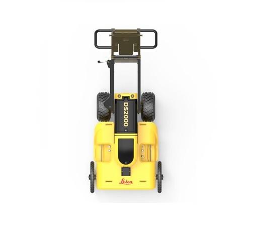
LEICA DS2000
Uncovering safer, faster, more.
There’s a lot going on underground that you need to know about before you ever start to dig. The Leica DS2000 Utility Detection Radar GPR finds all potential threats, including non-conductive pipes and fibre optics, increasing safety by reducing the risk of accidently hitting underground assets.
Increase safety, speed up work and lower asset management costs with the ability to prevent hazardous outages and collect more information. The DS2000 betters your business by making it safer, faster and more efficient.
Key benefits
Increase safety when the DS2000 identifies all potential threats
Get to assets and recover quicker from outages when you know exactly where underground utility assets are located
Dual-frequency antenna to detect deep and shallow targets simultaneously
Easily collect and understand data with the DS2000’s simple and intuitive software and data storage
Simple data storage and export to continue working on the post-processing at the office
Effortlessly maneuver around the most challenging sites with the DS2000’s advanced ergonomics
PROTECT by Leica Geosystems – the strongest warranty in the market
Detection and underground mapping solution
Combined with the powerful and rugged Leica CT2000 field tablet, the GG03 or the GPS60 smart antenna.
What does this add up to? Reduced work downtime, thus translate into higher productivity, resulting in reliability and accuracy at an extremely reasonable price. Test one for yourself at LES today.
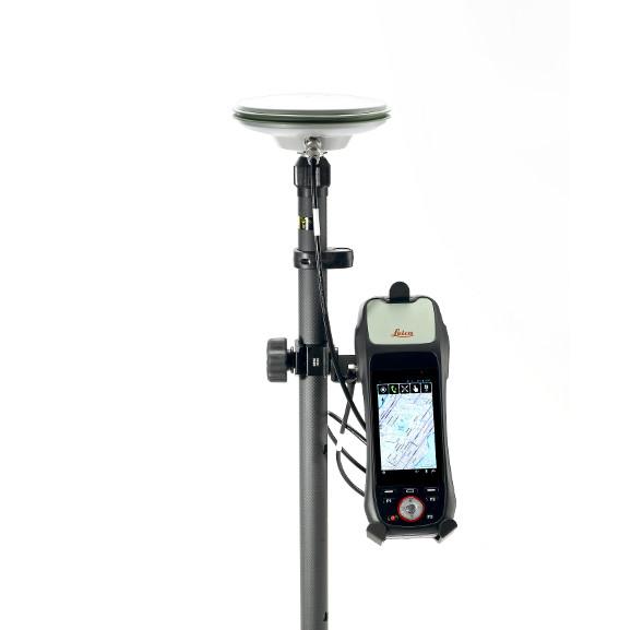
LEICA ZROVER GNSS/GPS SURVEY SYSTEM
LEICA ZROVER – FASTER, MORE ACCURATE ASSET MANAGEMENT
The construction industry is transforming to adopt digital ways of working. Traditional ways are often manual, time consuming and subject to human error.
Switching to digital asset management, by using the Leica ZRover solution, enables users to digitally locate, record and measure assets on a construction site with the highest accuracy, saving time and reducing errors.
Survey with Zeno mobile .Carry your CAD site plans with you for constant visibility, reducing the risk of mistakes happening, or going unnoticed.
Navigate accurately to a location on a construction site to carry out both new and existing installations, allowing you to check the accuracy against the CAD drawing.
Combined with Detection Systems such as a Radio detection 8100 with Bluetooth, navigate accurately to existing assets to avoid unnecessary damage.
Digitally record the length, direction and depth of an installed asset. reducing the risk of human error, and saving valuable time by carrying out the work whilst the ground is still open. Upload directly to Dropbox for full site to office workflow
Connect and use ArcGIS data collector app by ESRI. Create and share maps, collect data and upload to ArcGIS.
What does this add up to? Reduced work downtime, thus translate into higher productivity, resulting in reliability and accuracy at an extremely reasonable price. Test one for yourself at LES today.